Over twenty years ago, a friend of mine was giving me an impromptu lesson on coon hound training along a familiar creek on our farm. When his pup finally treed, we started into the woods at the creek crossing and three hundred yards later, turned left, away from the creek, and walked fifty yards uphill to the tree. We saw the raccoon, leashed the dog, and I led the way back to the creek to go home. The truck was upstream, to our right, but somehow I’d already made up my mind it was the other direction, and didn’t think twice when I turned left and started walking the wrong way. Darrel let me go about a hundred yards before giving me the title for this article. I insisted he was wrong, but after a lost wager and a big helping of roasted crow, the lesson finally hit home.
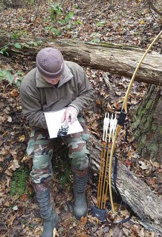
A baseplate compass and a USGSquad map is a reliable way to navigate through the forest.
Not long after that, a college professor handed me a map and compass, and thus began education about maneuvering in the woods. After school, years of professional forestry work, and untold hours spent hunting blocks of National Forest lands later, I’ve come to appreciate the instrument and what can be done with it. But there’s more involved than straight land navigation and simple triangulation. For hunters, familiarity with a compass can open doors to other unique uses to assist us in the field.
Several years ago, I was reviewing a USGS quad map and found something interesting, a creek bottom on Talladega National Forest, tightly tucked between a state highway and the main access road leading to other parts of the forest. After checking the aerials, I saw that it was flanked on one side by private timberland that had been recently harvested. I quickly did the math, and decided to give reaching it a try.
As I drove down that Forest Service road the following Saturday, the heavy brush just across the ditch looked intimidating. But through the cracks I thought I could see the underbrush thinning. I was still staring into the woods a moment later, when a pickup pulled in behind me. Not wanting to give away my plan, I pointed up into the trees at an imaginary hawk picking apart an imaginary squirrel, and quickly drove on.
After gearing up at the parking area, I slipped into the woods, working my way back toward what I’d seen from the truck. The undergrowth was thick but passable, and in the several minutes it took me to get back, I heard nine different vehicles coming in for the afternoon hunt. When the dust settled, I double checked the map, then turned north, away from the road, and in no time found what I was looking for. Just before dark, two does meandered in from the private land. Their timing was rotten though, and they didn’t approach until after it was too dark for a shot. I didn’t want to educate them, so I just sat there listening to them crunch acorns.
The deer ate their fill and left, and after a few minutes I reached into my pack and pulled out my GPS. Saving the coordinates would easily allow me to walk back to the same tree in the dark the next morning, but when I thumbed the power button on, nothing happened. I dug out my flashlight, opened the back of the unit, and realized the batteries were gone. It hit me all at once—the last time I’d used it, the low battery indicator had flashed. I’d taken the batteries out when I got home, but must have forgotten to replace them. (Before you laugh at me, I did check. The GPS unit took four AA batteries, while my flashlight operated on two.) As far as satellite navigation goes, I was dead in the water.
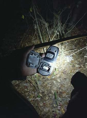
Now is not the time to discover that your GPS’s battery compartment is empty.
While I was having a few choice words with myself, I fished around in my pack looking for loose batteries. Of course there were none, but I did find some reflective tacks and half a roll of flagging. I automatically thought of marking a trail out to the road, but a freshly marked trail touching a well-used road on public land would all but ensure another hunter sitting in my spot the next morning. Then I saw my compass half hidden under a pack of zip ties, and a light bulb came on in my brain.
The Forest Service road was south of me, and I reasoned that if I closely followed a bearing to the road I could mark the point where I intersected it with a single piece of flagging. That would be easy to locate on the road by flashlight, and with no other markings leading away from it, nobody would be the wiser. Following a bearing through the woods was not a problem, but knowing where that one tree would be along that imaginary line in the dark the next morning worried me. It took a minute, but I finally decided the distance could be estimated by counting steps. Once on the ground, I twisted the compass bezel to due south and started walking. I was at 473 steps when I pushed my way through the last of the brush onto the Forest Service road. I memorized the number, and then tied a small piece of pink flagging on a tree branch.
The next morning, a full hour before light, I was standing in front of that small piece of flagging, compass in hand. I turned the bezel 180 degrees to due north, shined the light, made it through the initial tangle, and began walking and counting steps. Nothing looked familiar when I stopped at number 473, but I knew I had to be close. I shined the light all around and sure enough, to my left, eight steps farther, I saw my climbing marks on the trunk of the gum tree from the day before.
My compass and pacing wasn’t survey grade, but they were good enough. And although the deer didn’t come back that morning, I still enjoyed the satisfaction of having located a single tree in the forest with nothing more than a small piece of flagging, a compass, and the ability to count my own steps.
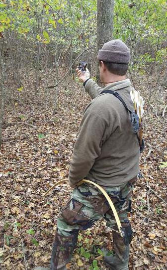
A compass will help keep you on track when your line of sight is minimal in thick forests.
Good compass work can do more than find landforms and stand locations in the dark. Given the right circumstances, it can also assist with game recovery. I was faced with just such an opportunity trying to recover my first selfbow kill back in 2009. After playing cat and mouse for a few weeks with a group of does in a wide travel corridor, everything fell into place one evening when they finally walked by in range. I was just about to draw when the lead doe somehow spotted me. She bobbed her head a few times, snorted, and trotted off out of range, leading a couple of does with her. To my surprise, two stayed behind, apparently not sensing her alarm. I quickly spun into position and picked a spot. Almost immediately, my wooden arrow had found its mark. The deer wheeled and ran, but just before the arrow snapped off against the brush, I saw that the shaft had penetrated only half its length in the upper shoulder. I was feeling good about the shot placement, but with that much arrow showing, I realized that an exit wound and a decent blood trail would be iffy at best.
The deer ran straight away from me, and moments after vanishing in the undergrowth, I heard what I thought was a crashing sound. Trying to cover all the angles, I quickly had my compass out and set a bearing, matching the wounded animal’s escape route and where I thought I heard it last.
After dark, I climbed down and began searching the impact area with my flashlight. Half of my broken arrow was lying on the ground next to a pinch of hair, and a few steps from there were a couple of drops of blood. After thirty more agonizing steps, I had found nothing new—the only thing I had was that bearing. I pulled the compass out, backed up to the tree I was in, and started slowly through the woods, letting the compass lead the way. Just as I suspected, there was virtually no sign of the deer’s trail, but after seventy yards following the bearing, I spotted the deer up ahead lying in the leaves. The compass bearing led me straight to my trophy.
With today’s latest whizz-bang scent control features, paying attention to the wind has nearly become a secondary concern for many bowhunters. But for those of us who don’t buy technology’s claims and still like to play the breeze, knowing which way the wind is supposed to blow is still important.
Just last year, I decided to hunt an area of National Forest that a friend had recommended. He’d shown it to me on a map at work, but I had never been there. Before light the next morning, I struck out from the parking area in search of his spot. Twenty minutes later I crossed a creek and climbed the gently sloping hillside beyond. It only took a couple minutes more to find the quadruple trunked water oak that he said was hot.
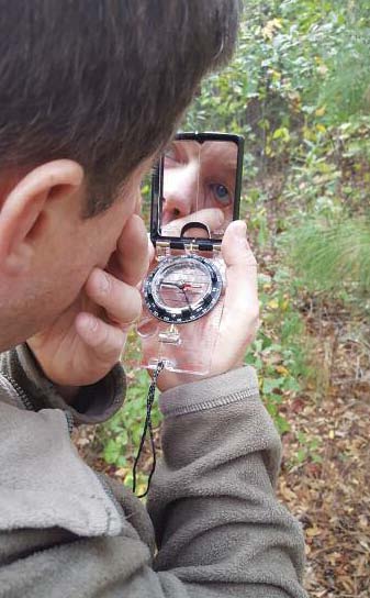
Mirrors on sighting compasses can be used for more than just acquiring accurate bearings. Here the author checks his eye for debris after a trek through rough country.
According to the weather report, I needed to be on the southeastern side of the trees to be downwind, but after circling a few times in unfamiliar woods in the dark, I didn’t know which direction was which. I thought about waiting until the sky lightened (showing me east), but first light was still thirty minutes away and I wanted to be situated and ready when it came. If the wind had been blowing, I could have used the wet-finger technique, but this particular morning, as is typically the case in the south, the pre-dawn wind was dead still. My instincts were screaming at me to do something, and suddenly I remembered my compass. As soon as the needle settled I knew which side of the oaks would be downwind, and I quickly found a tree I could climb. Once again, having a compass in my pack worked to my advantage.
When satellite service is poor, or the batteries in your phone or GPS fail (or are missing), there’s always the compass, possibly the least expensive, yet most reliable tool available to hunters. I whole-heartedly recommend getting one and learning how to use it. The woods may look different at night, but with a compass, you’ll always know where you are going.



I’m pleased to see a navigation primer from a forester that features a baseplate compass. As I told my navigation students over the years, a lensatic compass is fine for cruising timber and calling in mortar fire. A baseplate compass is superior for backcountry navigation, however. 🙂
You and your associates should be interested in learning more about a new smartphone compass app TruPath Compass – soon to be released on both Android and iOS smartphones..
TruPath Compass is the only smartphone compass app capable of correcting residual (after calibration) azimuth errors – commonly encountered. Also, TruPath Compass is capable of a) analyzing and b) providing azimuth correction parameters for any smartphone compass app, any rangefinder [with compass], and/or any electronic compass unit.
Visit my blog page at http://www.tru-path.corm to find examples proving TruPath Compass capabilities – examples listed at the top of the page.
If you are in need of having accurate smartphone compass azimuth results, please contact me for more information.
A unique, new accurate smartphone compass app ( AugView Compass ) has just been released on the Google Play Store and on the Apple store. I hope you will take a serious look at this “accurate” smartphone compass app – it’s the only available accurate compass app.
A link to the AugView Compass app is as follows:
https://play.google.com/store/apps/details?id=com.augview.augviewcompass&hl=es_419
It’s also available on the Apple store.
AugView Compass is capable of analyzing and prescribing azimuth error correction parameters for any a) other smartphone compass app, b) any rangefinder or binoculars with compass, and c) any electronic compass.
Research results supporting the development of this unique app can be found at http://www.tru-path.org
How accurate does your compass (direction finder) need to be for forestry applications?
I want to introduce you to the new AugView Compass app for smartphones (Android & iPhone). AugView Compass is the only accurate smartphone compass app available – using augmented reality to increase azimuth accuracy regardless of where in the world you may be.
AugView Compass can help you determine the level of accuracy (or lack thereof) of any compass – electronic, smartphone app, or otherwise.
For technical proof of AugView Compass accuracy visit http://www.tru-path.org and check out the associated research results posts. You could describe the AugView Compass app as an accurate “smartphone solar compass”.
I would encourage you to incorporate the AugView Compass app into your forestry work. Everyone has a smartphone.